Canal de Panamá
The Panama Canal will have been open for passage for one hundred years next year, and it is still rightly in many of the top ten wonders of the industrial world lists. Spanning the nearly fifty miles between the Atlantic and Pacific Oceans, it is a driving force behind present day shipping of goods around the world. As early as the 1500s, colonialists had pondered how to carve a channel through the thin strip of jungle that is Panama, and cut travel times from ocean to ocean in half. After completion of the 102mile long Suez Canal in Egypt, one of only half the length seemed almost a drop in the bucket. However, by its completion it caused the birth of a new nation, proved too much for another, cost half a billion dollars, and the loss of more than 25,000 lives.
After a failed attempt in the 1800s by the French, the United States and President Theodor Roosevelt picked up construction of the canal. Where the French had applied a similar approach as in Egypt by utilizing a continuous canal at sea level, the United States would try a system of locks that raise ships up and down over the land. To accomplish this, the entire landscape of Panama had to be changed. First and foremost, the region had to become its own country that the United States could exploit at its whim. When a rebellion erupted in the Colombian state of Panama, the United States blocked Colombian forces from entering the area to take control. The result in 1903 was the declaration of a new independence state called Panama. A year after independence, an agreement was made that allowed for a strip of land to be handed over to the United States for a canal.
In the years that followed, the construction of the Panama Canal created the world’s largest man-made lake and damn at the time. 1957 saw the Suez Canal Crisis in which the US helped force France and the United Kingdom to give up attempts at control over the that canal. However, it was not for another forty years, in 1999, that the United States would give up its own colony around the Panama Canal. The canal is now one of the largest sources of income for the country of Panama. That country is now undertaking massive expansion projects that will double the size of ships able to pass through the locks by 2014.
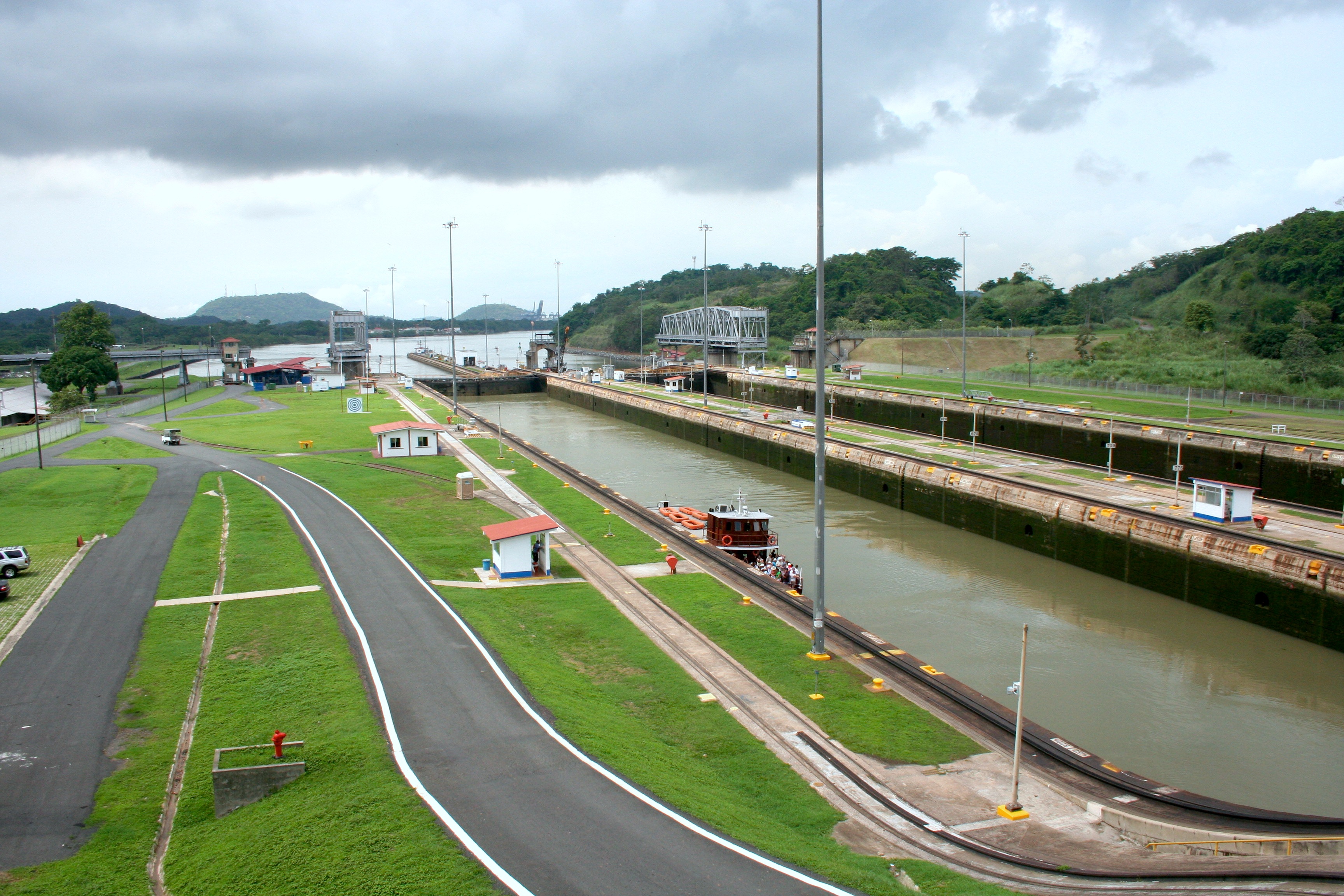
My initial mental image of the Panama Canal was more similar to what one would see at the Suez Canal. A long strip of water that goes essentially straight from ocean to ocean. The only difference I expected was the surrounding land covered in jungle rather than desert. The locks I imagine lifted ships up a little bit here and there as needed to compensate for the slight difference in sea level from end to end. In reality, the canal as viewable from Panama City reminds me more of a two-lane tollbooth with an elevator than a road. To one end, the gates open up into the Pacific Ocean, and to the other to the small Lake Miraflores. Beyond the lake is a stereotypical canal I imaged, but only for a short distance before it disperses into the much larger Lake Gatun.
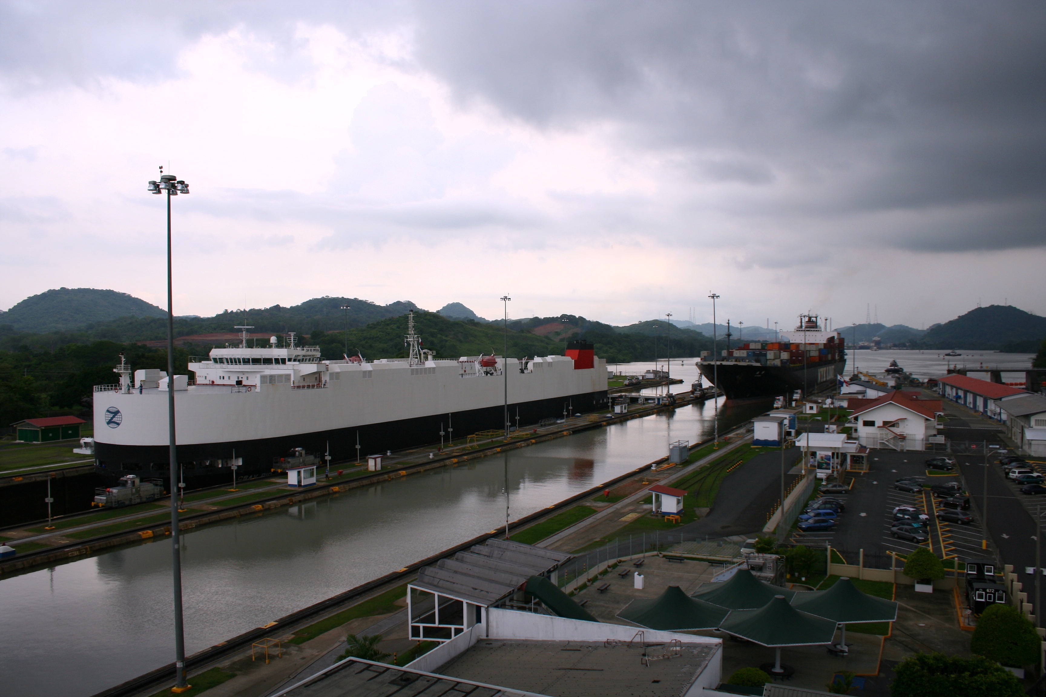
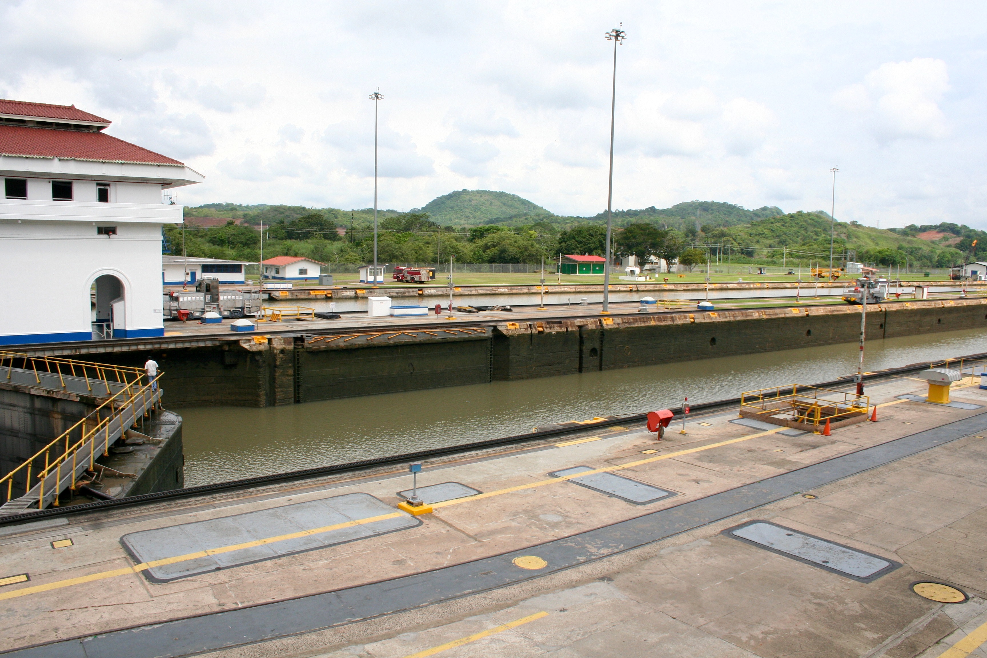
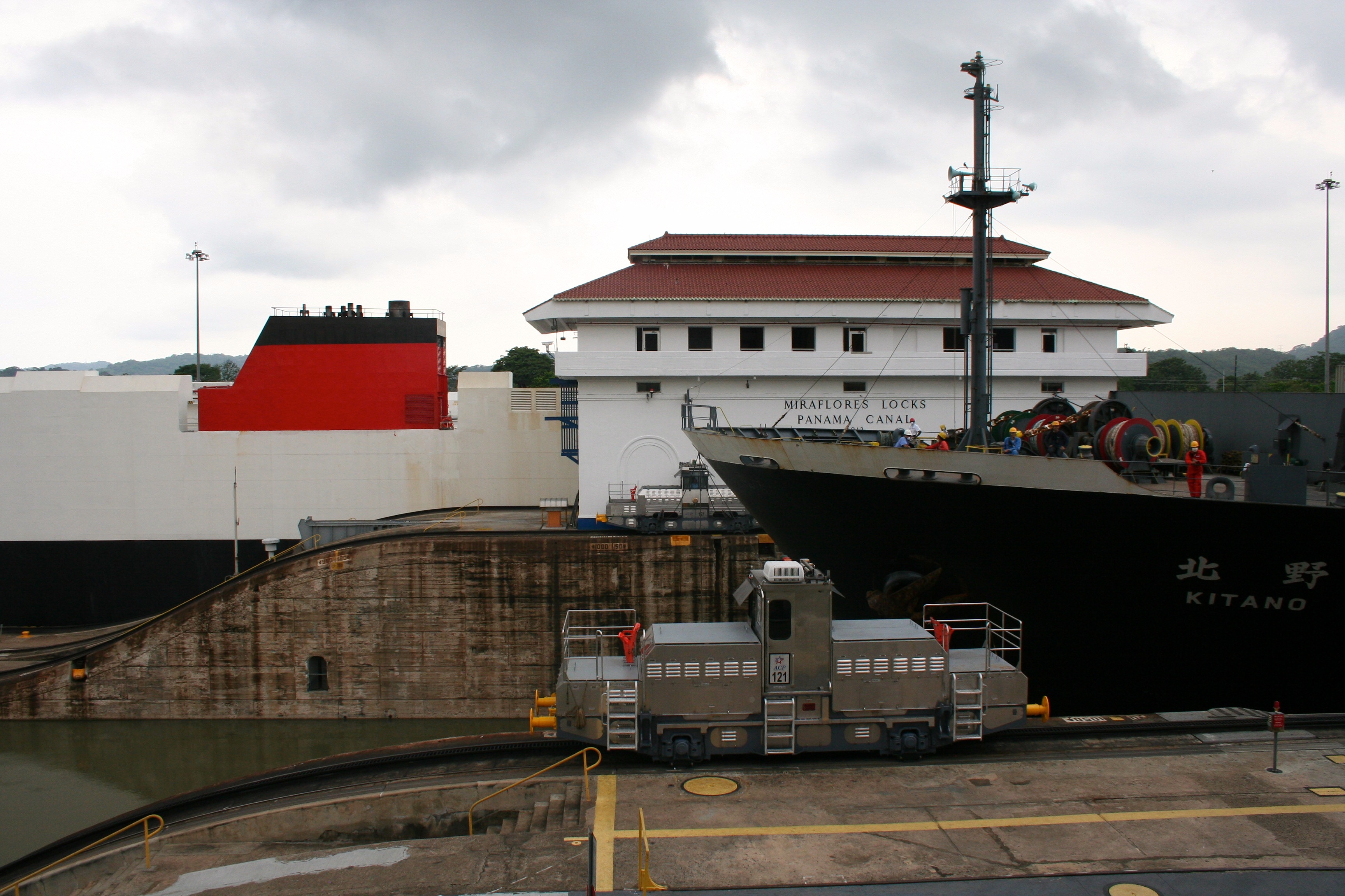
After perusing the visitor centre, which gives a pretty good representation of how much of trade is effected by the canal, we spent some time looking out over the locks from a raised observation balcony. It is a nice view of some lush green hills, and the rather small looking locks when one tries to imagine a giant cargo ship attempting to pass through. Unwilling to leave without seeing one such ship pass through the lock system, we sat for about an hour drinking expensive bottled water and scratching at sand fly bites from previous days on beaches. The wait was rewarded with two ships that approached from the depths of the canal.
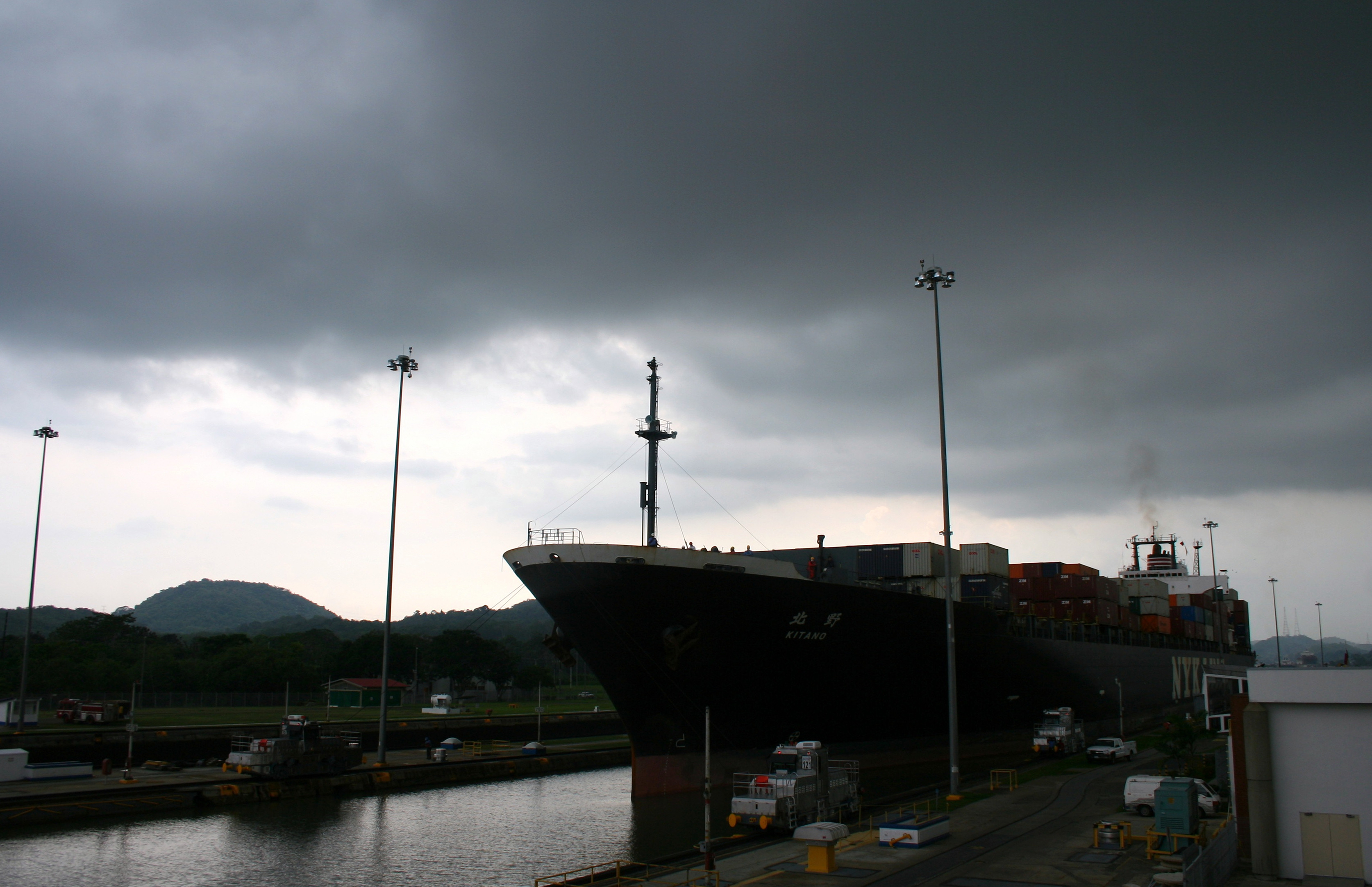
With their arrival at the end of each lane of locks, they were hooked up to multiple Japanese built rail cars. The metallic silver cars act as tug boats on tracks that slowly pull the ships through the narrow lock system. When I say narrow, I mean there are only a matter of inches between the sides of each ship and the concrete walls that hold back the earth. This is one of the reasons for the modern expansion; many ships cannot fit in the current system of water elevators. Each of the ships pulled into its pen before being closed in by two metal gates. Ships locked in place, the water slowly drained out of the box lowering them to the level of the next box. The forward gates then opened and the tugs pulled each giant forward again. The process was repeated, the tugs unhooked, and the ships left out into the Pacific Ocean. Nothing dramatic, no explosions or tall buildings to be seen. Just the simple flow of water that slowly raises ships up and down.
It is a typically unmentioned consequence of climate change, but the way in which goods move across the world would be a nearly impossible process without the Panama Canal. The route around South America adds an addition five to eight thousand miles to any trip depending on the destination. Distance is time, and time is money. The cost of anything that has to be rerouted the long way around would quickly be dropped onto the buyer. What does that have to do with climate change one may ask? Well, the water that runs the locks and allows ships to be raised and lowered all comes from the man-made lakes that connect to the canal. Gravity does all the work of filling and emptying the lock system. Because the lake is eighty feet above sea level, the water only needs an opening and it will flow down into the locks, raising their contents along the way. If a local consequence of climate change in the region is decreased rainfall causing a decrease in the level of the lakes, then the lock system could cease to work all together. Luckily for now, it began to rain as we watched the ships pass out into the Pacific Ocean. Ever so slightly refilling a small bit of the water that had just been lost to the ocean from the lake for the sake of moving goods around.
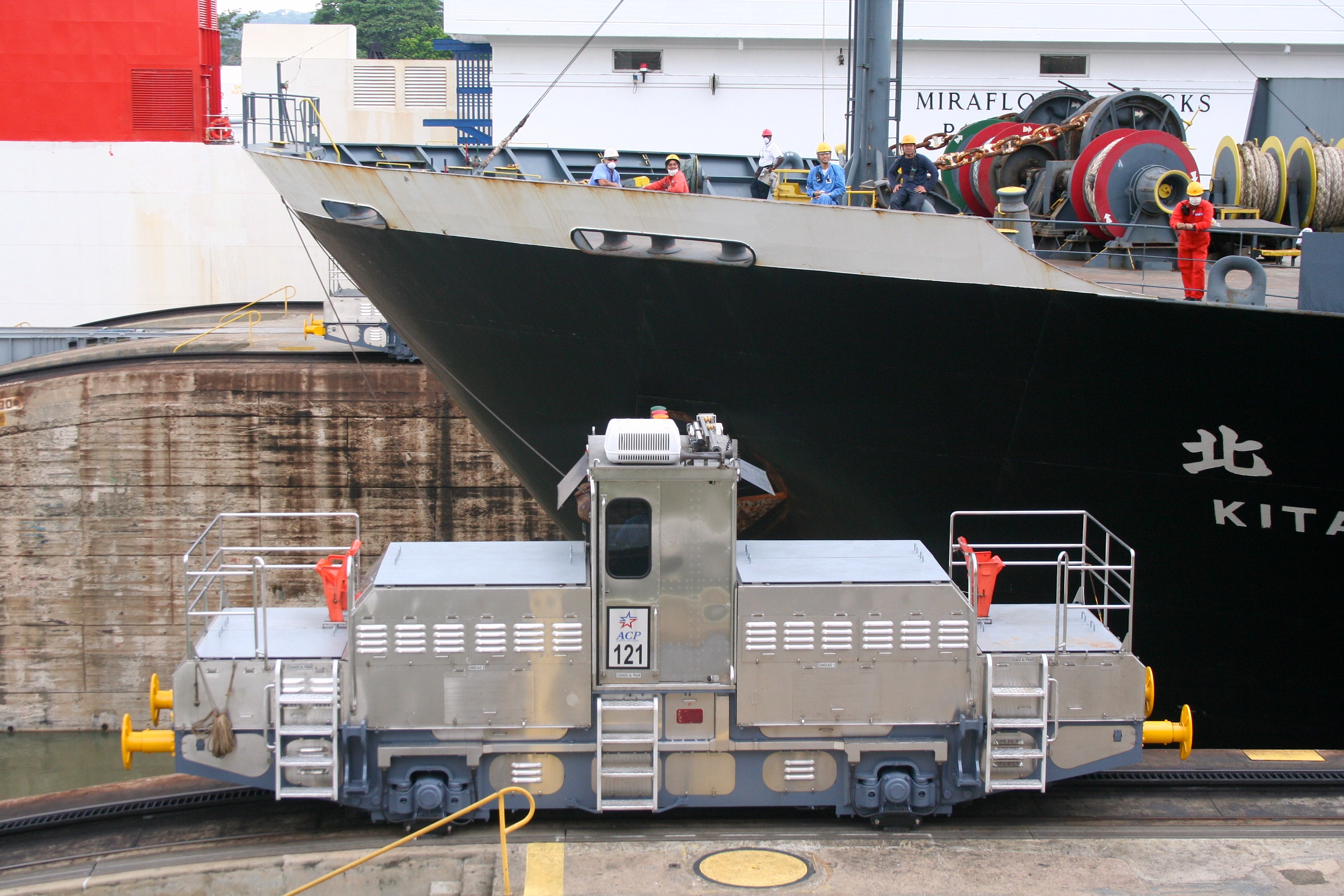
The canal is an engineering wonder that is not easily appreciated as others like it can be. Giant buildings can be seen from a distance in one view. The Panama Canal on the other hand cannot be experienced from one spot. While I have not yet had the opportunity to traverse the canal in a boat, watching a boat or two pass through the Mira Flores locks is a worthwhile experience. The lumbering size of the transports is impressive in their own right, but to see the precision at which they are maneuvered is awe-inspiring. I can only imagine the slow drama that would unfold should one go scraping along the side of the lock or break through one of the gates.
While South America starts at the border between Panama and Colombia, with the cut created by the canal, many now consider it the new dividing line. Even if it is now the meeting place of North and South America, the Panama Canal is a meeting place for much more than that, if only transitory. Ships from all and going to all over the world pass through the tiny space multiple times a day. I doubt many people imagine the power over modern trade that is held by the rather small and often unnoticed country.
