TWA Flight 6 – The Crash Site
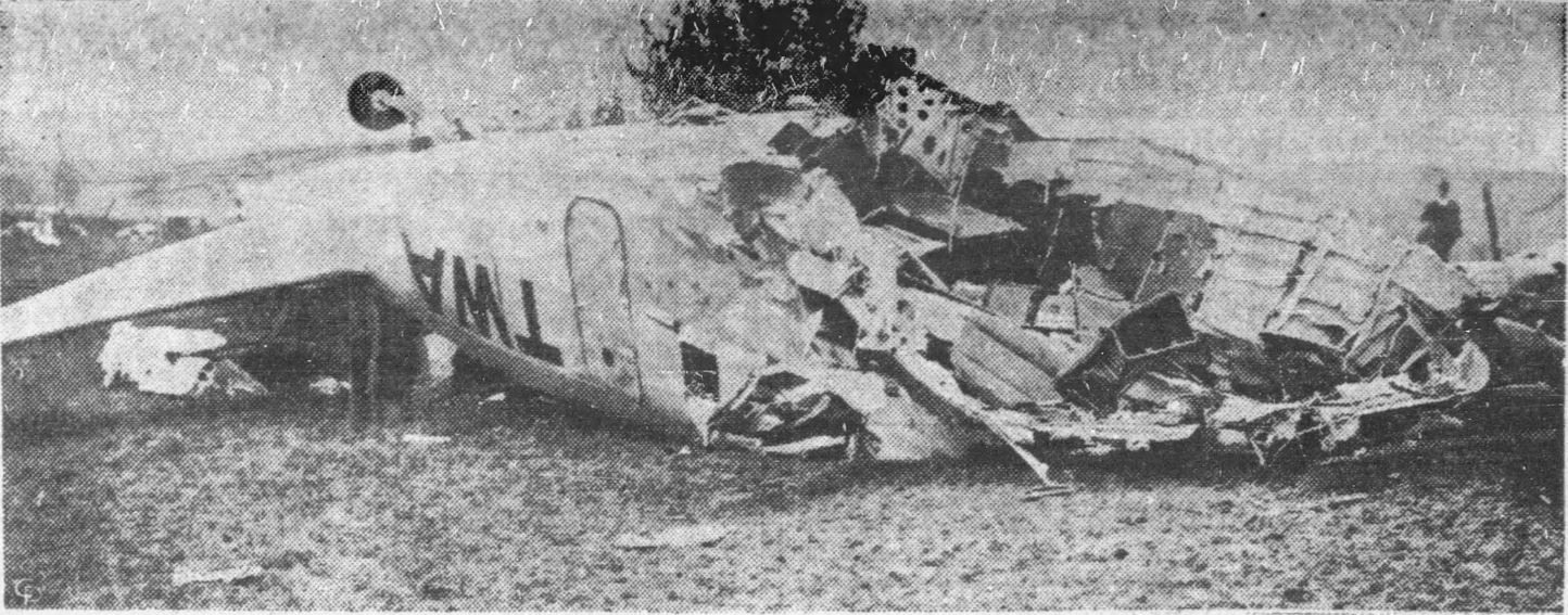
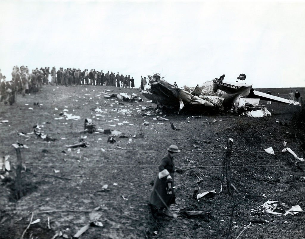
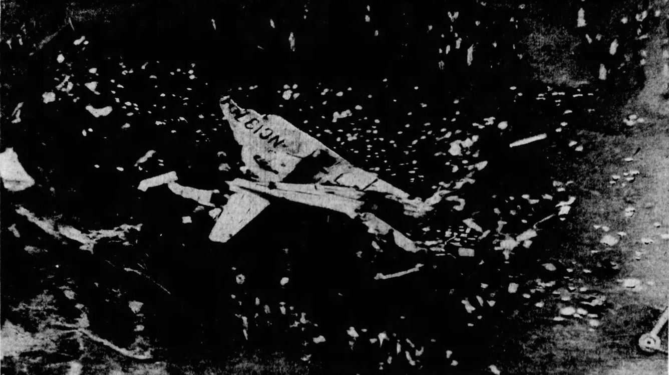
In the early morning hours on May 6, 1935, Transcontinental & Western Air Lines [TWA] Flight 6 crashed on farmland in rural middle Missouri. The all-metal three-engine Douglas DC-2 was operating the Albuquerque, NM to Kansas City, MO leg of a coast-to-coast trip from Los Angeles to New York (Newark, NJ); when in it impacted a hill in low clouds and fog killing a U.S. Senator and four others. Wreckage from the crash became the centerpiece of front-page photographs on the country’s newspapers over the following days, and the government inquiry resulting from the tragedy was critical to the restructuring of U.S. civil aviation incident investigations. Nearly nine decades later, the crash itself is largely forgotten. Historically, the accident is universally overshadowed by an event four years earlier. In 1931, Knute Rockne, head football coach at Notre Dame, was killed in the crash of a TWA Fokker F-10 in Kansas, about 250 miles south west of where TWA 6 met its end. That accident is credited with the widespread adoption of modern all-metal aircraft like the Ford Trimotor, Boeing 247, and Douglas DC-2 like the one operating TWA flight 6.
I first leaned of TWA 6 during the early days of the COVID-19 pandemic. Stuck inside and on the internet, I started to explore the idea for a project of “Then and Now” photographs of forgotten and unmarked locations of plane crashes. A substantial fraction of modern aviation tragedies are easy to locate, even when there is no memorial or obvious remaining signs of the disaster. It is 2022, and precise GPS coordinates are available on Wikipedia for a significant fraction of these incidents, and easy to cross referenced with descriptions in final investigative reports. However, this was not always the case, and aircraft accident reports from the 1930s are not all equally or especially detailed. Even with the extensive federal inquiry into the crash, the report issued for TWA flight 6 contains no map of the scene or description of location detailed enough to discern its exact position. Additionally, the only GPS coordinates found online do not match even the broadest description of the location. So where precisely did TWA flight 6 end in the early morning dark of May 6, 1935. With this “mystery” now to occupy myself, I attempted to locate the small nondescript hill and dirt road seen in the black and white photographs of the wreckage. Best case, I could use it for in my series of these ‘Then and Now’ images, worst case it was a good distraction.
Sorting through contemporary newspaper accounts, witness descriptions, and other historic documentation, I found myself a far more fascinating and complex story than I had anticipated with my initial goal of simply locating the crash scene. I don’t yet know how right or wrong I am about the final location in this story, but I have picked a road and hill that I believe are the same as those on which TWA flight 6 ended. Here is how I came to choose my geographic suspects.
Broad descriptions of the crashed airliner’s location refer to the nearby population centers of Macon, Atlanta, and Kirksville, MO. For the uninitiated in Missouri geography, that’s north central. Ten miles NW of Macon, eight miles SW of Atlanta, 15 miles S of Kirksville, five or six miles W of Atlanta, and so on. Each of these overall descriptions brings one roughly to the border of Independence and Liberty Townships, subsections of Macon County. An area of approximately 5,000 acres south of so called “Barnesville” with numerous non-descript hills and plenty of dirt roads still toady. I left it at that, satisfied enough for a few months, but continued to collect old articles about the event in hopes of narrowing my future foot search. Reading closer, a number of local newspapers from May 1935 say the aircraft came to rest specifically on the farm of Charles O. Bledsoe, or very near to its borders. At least one article claims the farm property in question is owned by John Gross, and another says Philip Nuhn. Further other papers describe the final resting plot as an “unattended farm” with no mention of the ownership. No matter whose name was on the deed or the state of the plot and farm home, these details were of little help in isolation and almost a century later. Enter my painfully expensive degrees in anthropology that taught me about plat books.
Plat books contain land ownership information from across townships all displayed as nicely organized maps. As fortune would have it, the plat book from Macon County in 1930 has been conveniently digitized and is available online. I scanned around the records from prior to the crash for any familiar family names in that general area south of Barnesville. What was essentially the northern rows of Liberty Township, and the southern rows of Independence Township on the plat maps. “Mason… Elliott…Taylor…” then there it was “Gross Est.” Just north of that, “C.O. Blidsoe” and neighboring “Phillip Nuhn.” Slight differences in spelling from the papers, but three names in a relatively small area seems to me like a good bet. Now it was just a matter of sorting out the disagreements amongst the various secondary accounts, and hoping the historic documentation I found online was close enough in time to the day of the accident to be applicable in my search.
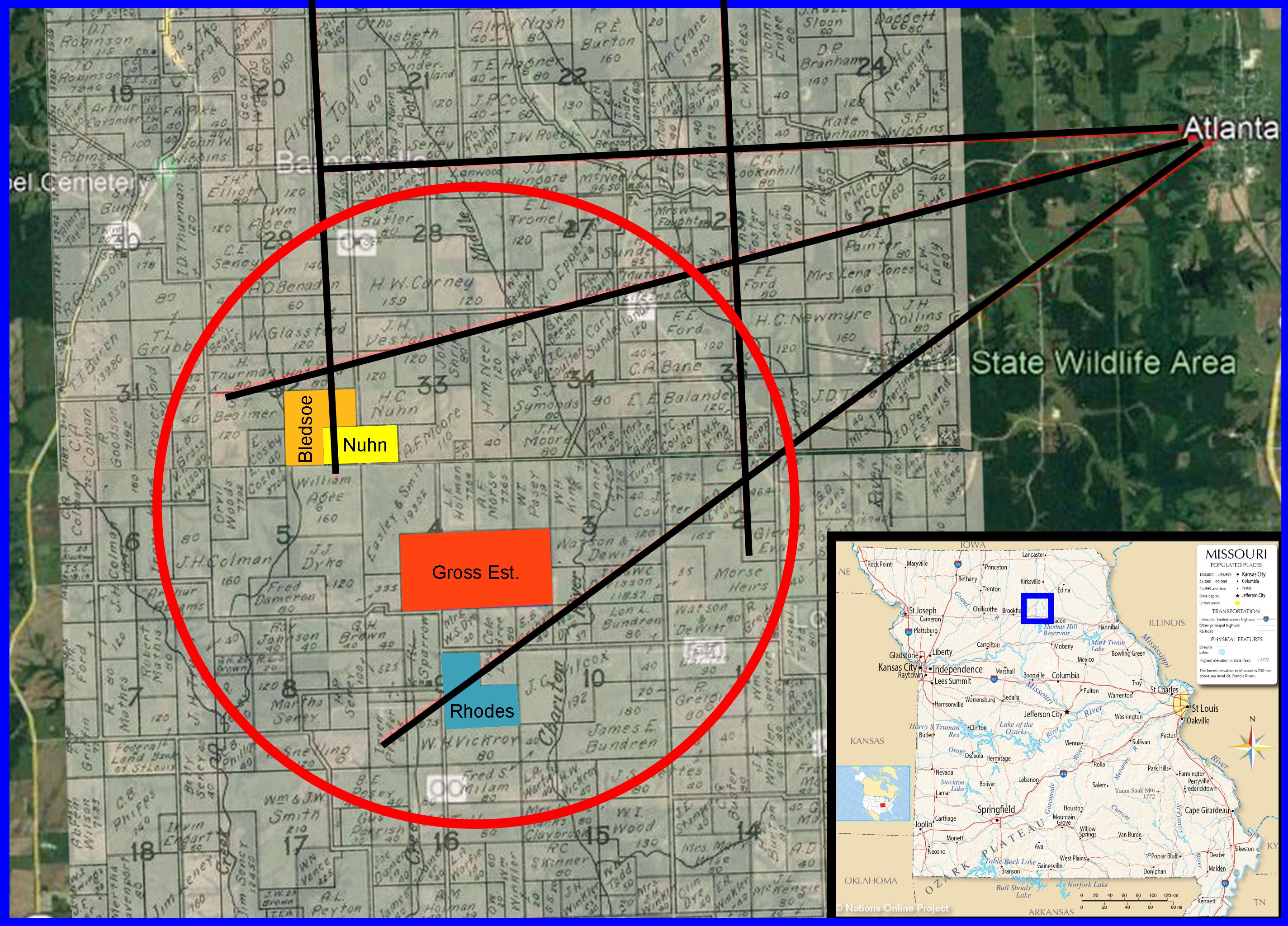
The Gross Est. is mentioned as the wreckage location in only one article as far as I can tell, I think it is simply inaccurate. The distances to structures adjacent the wreckage do not make sense when applied to the 1930 Gross Est. land location. However, near to the Gross Est. is the family plot and presumed location of two of the witnesses to the aircraft’s final airborne moments. Teenage brothers Nolan and Harry Rhoads see the DC-2 flying “east, then north, then northwest” before its lights disappear “near the Bledsoe farm.” While the aircraft was coming into the area either from the west or the south, at the time of impact it was flying towards the west or northwest, almost in the opposite direction. This is confirmed further by documents that describe the damage at the scene on both sides of the north-south oriented dirt road, with the wreckage ending up just beyond the western side. On the 1930 Plat Map, both the ‘C.O. Blidsoe’ and ‘Phillip Nuhn’ properties border a road on its western edge. The Macon Chronicle in their description of the aftermath notes “…the former home of Philip Nuhn… is across the road [from the crash] a piece to the north east.” Another historic map, a topographic one from 1937 indicates that the buildings on these properties lie on opposite sides of the road with Bledsoe on the west side and about 1/4 mile north of Nuhn on the east side. The former home of P. Nuhn may also indicate that the residence was not in use at the time of the crash and could therefore be the same ‘unattended’ farm mentioned as the crash site and not some fourth potential location. This narrows my search to an area of of only about 10 acres, about the size of a small hill.
Although there are some disagreements in the accounts of the accident location and sequence of events that followed, I feel confident in my assessment of the location to this relatively small area. My search for the location of TWA 6 began as visual quest with the hope of adding a very old but exceptionally well photographed aviation disaster to my growing list of ‘Then and Now’ crashes to visit and document. However, in the process of searching through pages of documentation to find this anonymous hill in rural Missouri I came to appreciate the unusual details and story behind the crash and its aftermath far more than I expected. In the next part of this small series: the sequence of events that night leading up to and immediacy following the crash.

Wow! You’ve done a lot of research, way to go!